ecoCollage

GRANT-FUNDED and SPONSORED RESEARCH COLLABORATION / 2014–2015
Supported by the Metropolitan Water Reclamation District of Chicago, UIC Learning Science Research Institute, College of Urban Planning & Public Affairs, UIC Biology, Ecology, and Computer Science.
Like many cities, Chicago experiences extensive surface flooding during heavy rainfalls that puts pressure on the combined sewer system. Climate change only intensifies the magnitude and frequency of what used to be “hundred-year storms.” The need for Green Infrastructure (GI) is clear, but across the city’s topography of public, private, and mixed ownership, who will fund these initiatives and what could their impacts be?
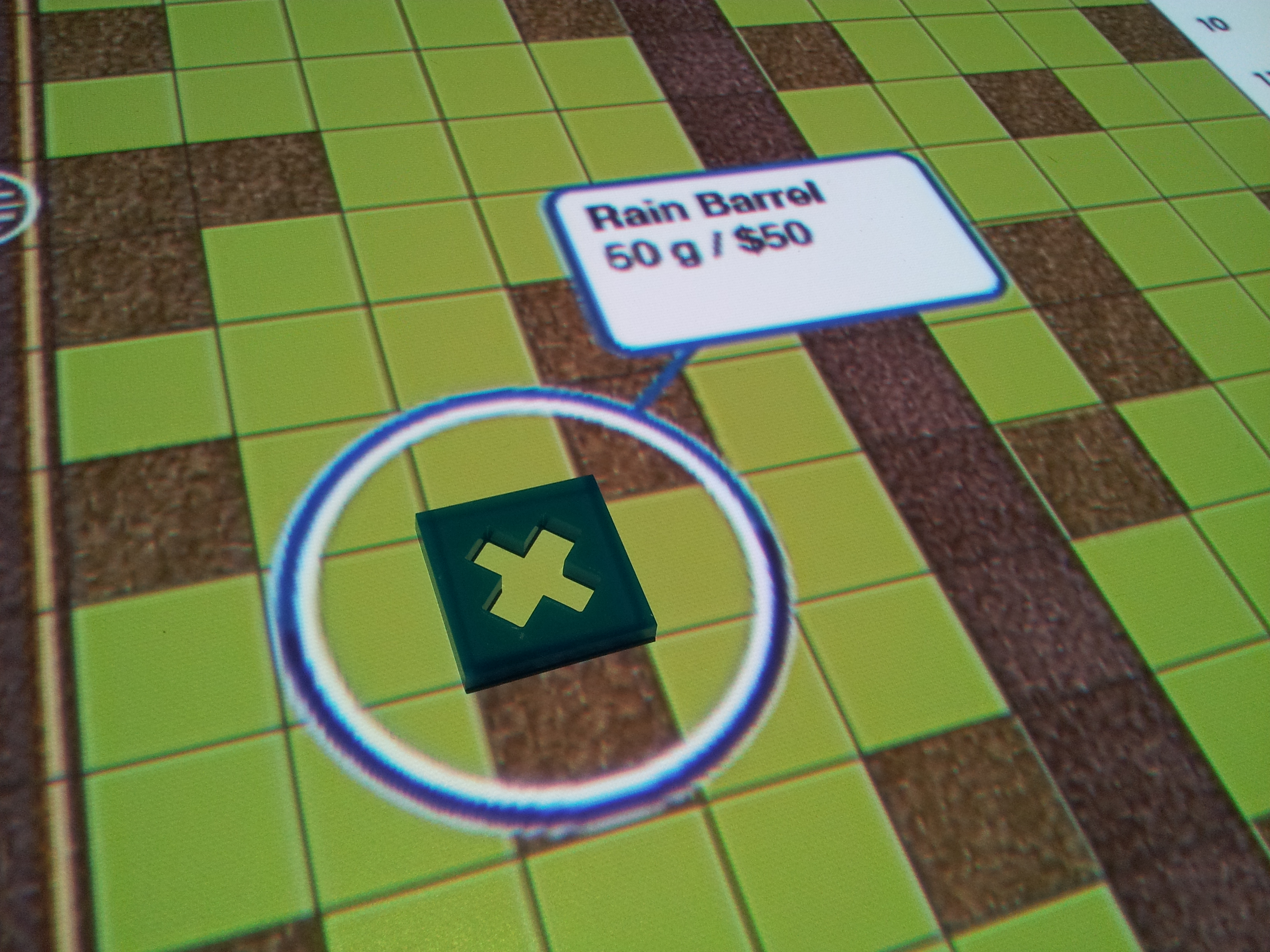
‘ecoCollage’ was a multi-user Tangible User Interface system designed for community level, collaborative, and iterative planning to mitigate surface flooding in Chicago. Participants were able to explore & test the effects of various green infrastructure (GI) elements within a specific neighborhood by placing game tiles onto a projection of that area's topography. The locations of each GI element were read by a computer vision system and input to a hydraulic simulation engine—a simplified version of one built for the Illinois EPA. Players gained immediate visual feedback on the scale & cost of each GI element when placed on the board. Once a plan was made, the resulting effects from a variety of storm types were visualized by an animated sequence of water flow interpreted from the hydraulic simulator. Players could use specific tiles to operate the system's dynamic legend in order to revisit previous arrangements to continually iterate upon their plans for infrastructure placement.
![]()
![]()
![]()
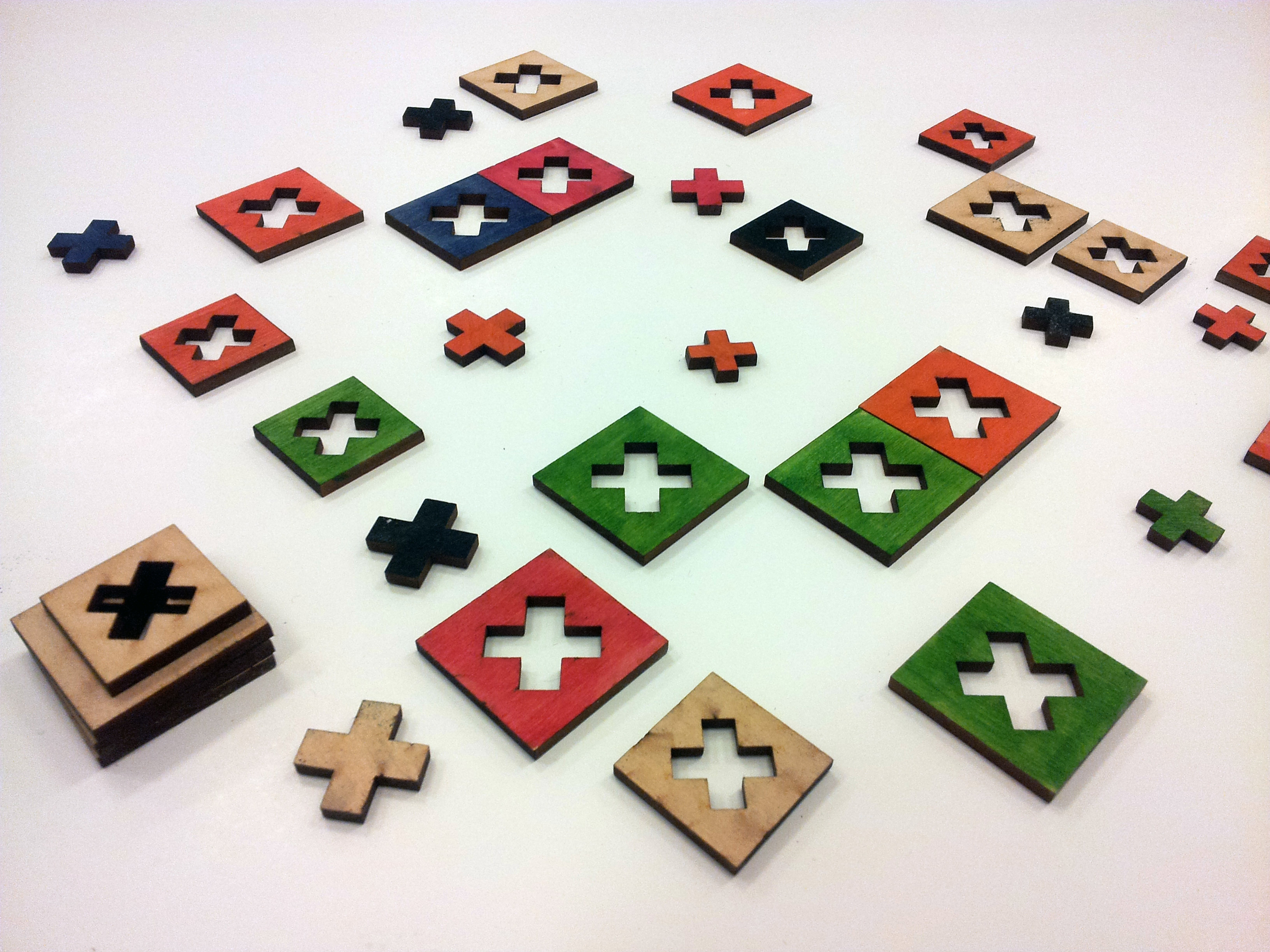
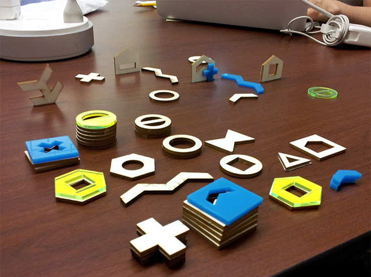
The inherent design challenge was to produce simple game-like tiles that can be easily interpreted by both the computer-vision system and community collaborators. Hundreds of prototypes were created to test color & feature recognition capabilities as well as material & scale. The interface design for ecoCollage was conducted by the Responsive Media Lab at the UIC Innovation Center.
—
PI: Leilah Lyons; Co-PIs: Moira Zellner, Emily Minor; Advised by: Tom Moher Jim Pellegrino Susan Goldman; Graduate Assistants: Tia Shelley, Brian Slattery, Chandan Dasgupta
Funded by NSF REESE Award #1020065: Integrated Study of Natural Resources, Human Impact, and Environmental Policy: Making Complex Systems Accessible for Secondary Learners
‘ecoCollage’ was a multi-user Tangible User Interface system designed for community level, collaborative, and iterative planning to mitigate surface flooding in Chicago. Participants were able to explore & test the effects of various green infrastructure (GI) elements within a specific neighborhood by placing game tiles onto a projection of that area's topography. The locations of each GI element were read by a computer vision system and input to a hydraulic simulation engine—a simplified version of one built for the Illinois EPA. Players gained immediate visual feedback on the scale & cost of each GI element when placed on the board. Once a plan was made, the resulting effects from a variety of storm types were visualized by an animated sequence of water flow interpreted from the hydraulic simulator. Players could use specific tiles to operate the system's dynamic legend in order to revisit previous arrangements to continually iterate upon their plans for infrastructure placement.


The inherent design challenge was to produce simple game-like tiles that can be easily interpreted by both the computer-vision system and community collaborators. Hundreds of prototypes were created to test color & feature recognition capabilities as well as material & scale. The interface design for ecoCollage was conducted by the Responsive Media Lab at the UIC Innovation Center.
—
PI: Leilah Lyons; Co-PIs: Moira Zellner, Emily Minor; Advised by: Tom Moher Jim Pellegrino Susan Goldman; Graduate Assistants: Tia Shelley, Brian Slattery, Chandan Dasgupta
Funded by NSF REESE Award #1020065: Integrated Study of Natural Resources, Human Impact, and Environmental Policy: Making Complex Systems Accessible for Secondary Learners